What happened
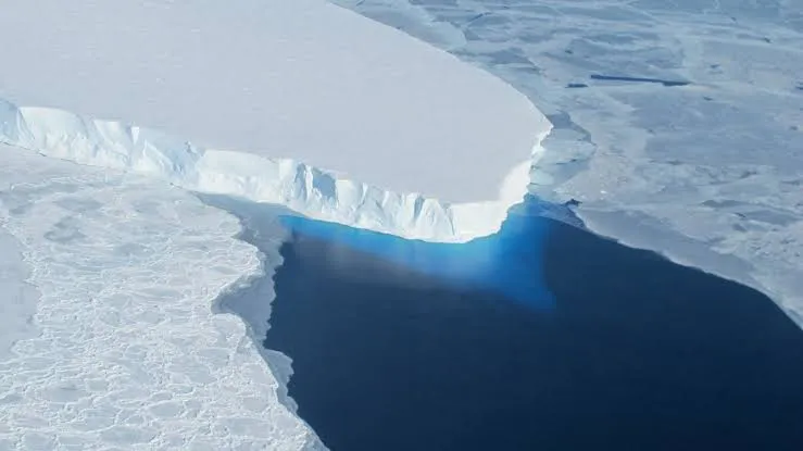
- NASA published on October 20, 2026 the results of a study that refines projections for the Thwaites Glacier in West Antarctica. The paper appeared in Nature Communications on October 12.
- In some simulations, the glacier’s contribution to sea level by the end of the century reaches twice current projections.
- The model was built by NASA’s Jet Propulsion Laboratory (JPL) with the University of California, Irvine and Dartmouth.
- Unlike others, it does not treat the shift from ice to water as a line but as a grounding zone several miles wide, where tides lift the ice and seawater enters beneath it, warming the grounded ice and speeding melt.
- It matches satellite observations since the 1990s about four times more closely than models that omit that zone.
Why it matters
- Sea level is a cost paid on the coast. A glacier contributing twice what was forecast changes the calculations for defenses, insurance and land-use plans in port cities.
- For Chile and the region, with large cities and ports on the sea’s edge, the finding forces a review of coastal planning scenarios that use the earlier projection.
- The consequence NASA does not quantify: the release gives no figure in millimeters or a year. “Twice” is a multiplier on a projection, not a height.
The number
Four times closer. Fit of the model with a grounding zone versus those without it, when compared with satellites.
Context
Thwaites is among the glaciers that glaciologists watch most closely, because of its size and because its base sits below sea level. This note rests on an already published study: today’s fact is NASA’s outreach, not a new result. On the energy and cost of the computing behind these models, see data centers and energy in Massachusetts and the carbon footprint of AI papers.
What’s next
- The authors announce no calendar of new projections.
- Pending: other models incorporating the grounding zone and comparing results.
- No announced dates.
Bottom line
The computing used to estimate Antarctic ice competes with what AI uses: data centers strain the power grid and share with these simulations the same scarce resource: electricity.
Sources
- NASA — NASA Study Refines Projections for Thwaites Glacier (October 20, 2026)
- Nature Communications — Thwaites study (DOI 10.1038/s41467-026-77976-1, published October 12, 2026)
Edited by Rodrigo Cornejo. How we select and verify: who writes these notes.